SAR radar workshop
Justification The use of Radar SAR images in agriculture is becoming increasingly common, however, it is necessary to deepen the knowledge of the advantages and limitations
Justification The use of Radar SAR images in agriculture is becoming increasingly common, however, it is necessary to deepen the knowledge of the advantages and limitations
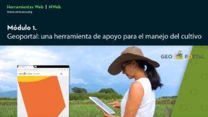
Use of the tools available at www.cenicana.org to support decision making in the management of sugarcane cultivation Training in the web tools created by Cenicaña
In this Webinar, the EOS Crop Monitoring and OneSoil mobile applications are presented, with which it is possible to continuously monitor crop diversity with satellite images.

With the purpose of showing professionals in the sugar cane agroindustry the trends in remotely controlled aircraft (RPAS) or drones and their applications in
Remote sensing, also known as remote sensing or remote sensing, is the science of acquiring, processing and interpreting images and/or data, captured from aircraft or satellites, which record the
A GIS is a set of methods, tools and data that are designed to capture, store, analyze, transform and present geographic information applied to various purposes.
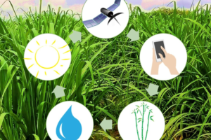
Technologies that seek to optimize agricultural production through the management of field variability.
Precision work improves the efficiency that Cenicaña evaluates are as follows:
The map server integrates the geographic information system (GIS) database of the sugar sector with the databases of commercial production and the network